Through diverse research projects, I have developed techniques and approaches to identify and characterise surface expression of tectonic deformation at different space and time scales in a wide range of landscapes combining topographic datasets, field observations, geological mapping, morphological analyses, and numerical landscape modelling.

Tectonic and Climatic interplay at the Andean subduction zone:
a morphological perspective
a morphological perspective
|
Where Andean Subduction margin
Atacama Desert North Chile Scales Time: 5 Myrs
Space: 700 km x 150 km Techniques Geomorphological and geological mapping
Topographic data and satellite imagery analyses River drainage extraction and analysis Numerical landscape evolution modeling Results Geomorphic threshold controlled by precipitation distribution
Drainage incision is controlled by tectonic uplift over the last 5 Myrs The andean orogen is growing westwards Publications Coudurier-Curveur A, Lacassin R, Armijo R., 2015.
Andean growth and monsoon winds drive landscape evolution at SW margin of South America. Earth and Planetary Science Letters. 414:87-99. Armijo R. , Lacassin R,, Coudurier-Curveur A, Carrizo D. 2015 Coupled tectonic evolution of Andean orogeny and global climate, Earth-Science Reviews 143 (2015): 1-35. |
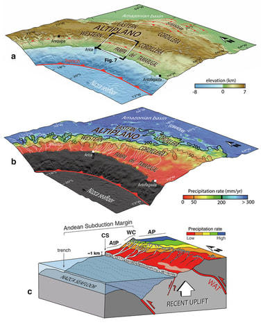
Andean Subduction margin, North Chile. (a) Topography, (b) rainfall pattern, (c) working hypothesis showing canyon incision is driven primarily by uniform uplift and secondarily by rainfall gradient over the northern margin. Coudurier Curveur et al., EPSL, 2015
|

Seismic hazard: surface ruptures and earthquake recurrence intervals
|
Where Assam, NE India
Arakan Plate Boundary, Bangladesh Himalayan foothills, Central Nepal Scales Time: 100 to 1000 yrs
Space: m to 100 kms Techniques Quantitative geomorphology,
Paleoseismology, Topographic data acquisition Rock sampling for 14C and 10Be dating methods Results The 1950 Assam earthquake has ruptured 2 sub- orthogonal thrust planes
We identified and characterised a >200 km long surface rupture for that earthquake Similar M8+ earthquakes seems to occur every 1500 to 2000 yrs Publications Coudurier-Curveur, A., Tapponnier, P., Okal, E., van der Woerd, J., Kali, E., Choudhury, S., Baruah S., Etchebes, M.,
Karakas, C. , 2019, A composite rupture model for the great 1950 Assam earthquake across the cusp of the Eastern Himalayan Syntaxis, EPSL. Coudurier-Curveur, A., Kali, E., Tapponnier, P. Karakas C., Baruah S., Choudhury S., Ildefonso S, van der Woerd J., Repetitive great earthquakes shape the landscape of the Eastern Himalayan Syntaxis over the last 9 ky., in prep |
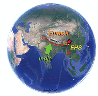
Eastern Himalayan Syntaxis and context of the study
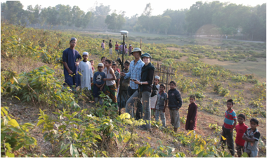
Topographic survey in the field, surrounded by curious children
|

Subaks In Bali: where science and anthropogeny meet
|
Where Bali, Indonesia
South East Asia Scales Time: 100 to 1000 yrs
Space: m to 1 kms Techniques ROI-based processing (Region Of Interest)
Satellite images analysis Aerial photographs Results In Bali, the cooperative management of rice terraces extends beyond villages to whole watersheds.
We show how cooperation can propagate from pairs of individuals to extended groups, creating a resilient system of bottom-up management Publications Lansing J. S., Thurner S., Ning Ning Chung, Coudurier
Curveur A., Karakas C., Fesenmyer K.A and Lock Yue Chew, Adaptive self-organization of Bali’s ancient rice terraces, Proceedings of the National Academy of Sciences, 114(25), 6504–6509, 2017 |
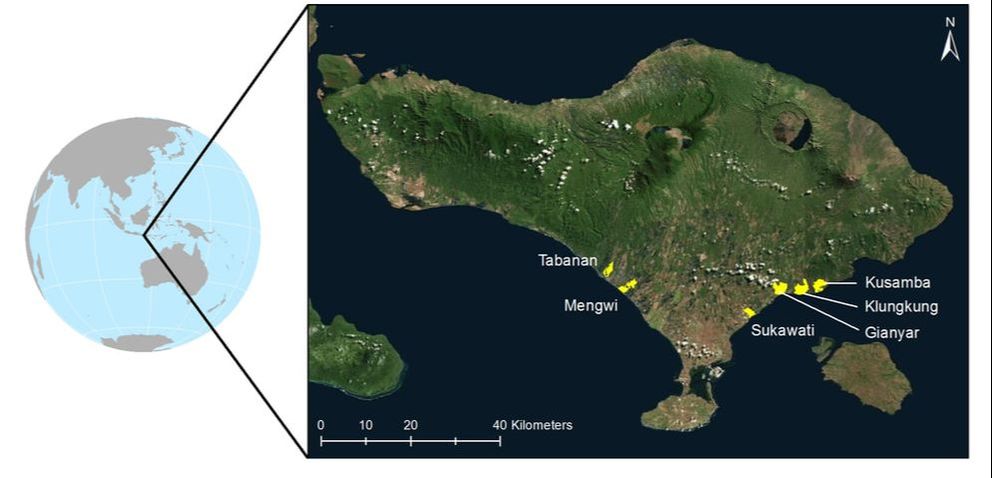
Bali Island, Indonesia and sites of the study
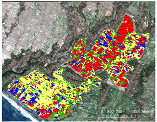
ROI classification of rice paddies in Mengwi
|

MIRAGE - MARINE INVESTIGATION OF THE RUPTURE ANATOMY OF THE GREAT EARTHQUAKE - Reactivation of Fracture Zones in the Wharton Basin
|
Where Wharton Basin
Indian Ocean Scales Time: 10 yrs to 1 kyrs
Space: 100 m to 100 kms Techniques Bathymetric analyses
Topographic stacks Results One of the reactivated Fracture Zones (FZ) in the Wharton Basin displays 60 well-
developed pull-apart basins which record vertical and horizontal deformation over the last 2 Ma. The estimated slip rate along F6a is comparable to those identified along world- wide plate boundaries suggesting that this FZ could be a nascent plate boundary thus challenging our understanding of oceanic plate tectonics. Publications Coudurier Curveur A., Ç. Karakaş, S. Singh, P.
Tapponnier, H. Carton and N. Hananto. Is There a Nascent Plate Boundary in the Northern Indian Ocean? Geophysical Research Letters, 47, 2020 https://doi.org/10.1029/2020GL087362 |
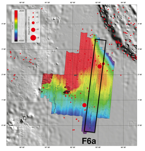
View of the detailed bathymetry of the Wharton Basin acquired during the MIRAGE experiment (S. Singh)
|

Coastal topography of Northern Luzon, Philippines: record of subduction zone uplift and/or offshore splay faults activity?
|
Where West coast,
Northern Luzon Philippines Scales Time: 1000 yrs to 1 Myr
Space: 100 m to 100 kms Techniques Topographic analyses
ALOS data (NTTdata) Results Work in progress
|
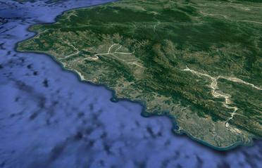
Google Earth view of the western coast of Luzon island
|

Earthquake and tsunami hazards along the Banda Arc
Insights from an ocean-continent subduction to continent-Island arc collision
Insights from an ocean-continent subduction to continent-Island arc collision
|
Where Banda arc
Eastern Indonesia Scales Time: last 5 Myrs
Space: 1 km to 100 kms Techniques Multibeam data
Seismic lines Results Work in progress
|
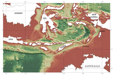
Bathymetric map (SRTM30+) of the Eastern Indonesian arc
|
Contact Me
|
|
|
